Presentation
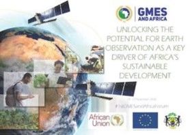
The GMES & AFRICA program is a joint European Union-African Union initiative, under the coordination of the African Union Commission through the Department of Human Resources, Science and Technology, and which aims to promote the development of capacities and resources institutional, human and technical for access to the operation of basic services on Earth Observation as an operational basis for sustainable development in Africa. The program is an important vector for the implementation of the Joint Africa-EU Strategy as well as Space Strategies and Policies in Africa, aligned with Aspiration 7 of Agenda 2063 of the African Union.
Thematic

“Water and Natural Resources Management” in Central Africa is led by a consortium of 6 members, under the coordination of CICOS. It is :
-
OSFAC (Satellite Observatory of Central African Forests: www.osfac.net)
-
CBLT (Lake Chad Basin Commission: www.cblt.org)
-
CRH (Hydrological Research Center: www.irgm-cameroun.org)
-
GIE-SCEVN (Economic Interest Group-Joint Waterway Maintenance Service: www.gie-scevn.com)
-
UNIKIN (University of Kinshasa: www.unikin.ac.cd)
Overall objective of the project
“Promote sustainable management of natural resources by improving the decision-making process by making available additional relevant information”. This by improving access and relevant use of Earth Observation data in regional institutions responsible for environmental management in Central Africa and in the following countries: the Republic of Burundi, the Republic of Cameroon, the Central African Republic, the Republic of Congo, the Democratic Republic of Congo, the Republic of Gabon, the Republic of Equatorial Guinea, the Republic of Chad and the Republic of Sao Tome & Principe.
More specifically, it is a question of responding to the concern for the consolidation and improvement of the classic observation system which is currently not very operational in the region, by using satellite data (water levels, precipitation, evapotranspiration, indices of vegetation, flow, etc.) so as to satisfy the needs of the main users of water resources (navigation services, meteorology, hydrology, hydroelectricity and drinking water production, agropastoral services, forest management and protected areas, etc.), on the one hand, and to contribute to decision-making in the implementation of policies for planning uses and opportunities for future developments relating to water and natural resources by promoting access and relevant exploitation of Earth Observation data, on the other hand.
Services developed
Data needs: Water heights (in situ, spatial), bathymetry, hydrographic
Service Manager 1 : GIE-SCEVN (Economic Interest Group-Joint Waterways Maintenance Service)
Data needs : In situ data: water height, precipitation, flow rates, evapotranspiration; Spatial data: precipitation, water height, land use, evapotranspiration, soil humidity, etc.
Service Managers 2 : GIE-SCEVN (Economic Interest Group-Common Waterway Maintenance Service) and CRH (Hydrological Research Center: www.irgm-cameroun.org).
Data needs : In situ data: forest, wildlife, climatic inventories, etc. Spatial data: sentinel, landsap and high resolution images, for analysis, verification and validation Informative products Water level forecast bulletin, monitoring bulletin, etc. Information products Water balance monitoring bulletin, rainfall index maps, ETP, etc. Informative products Thematic maps of flooded forests, statistics on analyzes of losses of biodiversity, biomass, carbon and emissions, etc.
Service Manager 3 : OSFAC (Satellite Observatory of Central African Forests)
Expected results
-
Strengthen data access infrastructure – Ensure and increase data, knowledge and access to information;
-
Develop, consolidate and extend operational applications supporting the water and natural resources management service;
-
Strengthen human capacities in Earth observation through the establishment and execution of a training program at the Continental, regional and national levels;
-
Raise awareness and strengthen the capacities of decision-makers
Contacts
-
Mrs ENAW born Judith EFUNDEM AGBOR
-
Georges GULEMVUGA GUZANGA
Contacts
cicos_inst@yahoo.fr/ georges_gul@yahoo.fr
+243 828484565 | +243125103565 | +243818970966
Project Partners